Three Zones
Rolesville’s Main Street, though a 4-mile corridor with clear ends now with the construction of the US 401 Bypass, also called Louisburg Road, is not a monolith. From one end to the other, Main Street takes on distinctive characteristics. Early in the planning process it was noted that the volume traveled daily, adjacent land uses, building typology, and activities occurring along the roadway are different for certain segments of Main Street. These varied characteristics lent themselves to highlight two major transition points for the corridor: the two key intersections of Main Street, the Burlington Mills and Young Street intersections.
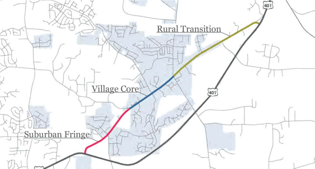
At these locations, it was evident that Main Street cannot be treated the same way along its full length because Main Street had not development the same way along its full length. Main Street is divided into three transition zones:
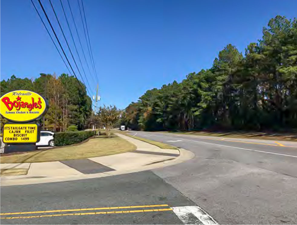
1. Suburban Fringe
US 401/Louisburg Road (South Entry) to Burlington Mills Road
1.2 miles
From US 401, Main Street is a 2-lane, undivided roadway and transition to 3-lanes with a center turning lane beginning at Lonnie Drive. Much of the road has no paved shoulders, sidewalks, or curb and gutter. Several subdivisions have direct access to Main Street from Lonnie Drive, Jonesville Road, and Hampton Lake Drive. No houses line the street but a few commercial businesses dot this segment, including the Bojangles drive-through restaurant. In between these few points of activity along the corridor are large parcels of vacant forested land for sale and some smaller plots used for farming.
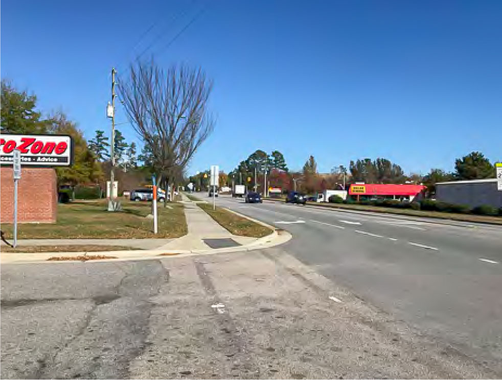
2. Village Core
Burlington Mills Road to Young Street
1 mile
At the Burlington Mills Intersection, Main Street widens to a 3-lane roadway, with the center lane acting as a “suicide” lane. Various left and right turn lanes are in use to allow access to shopping centers and stores, making the cross section consist of a 4-lane road. Sidewalk continues along the north side from through the entire stretch. Sidewalk on the south side begins at Wall Creek Drive and runs north. The surrounding land uses include commercial, retail and office buildings, an elementary school, and strip malls. There is more curb, gutter, and driveway curb cuts throughout this zone than present in any other zone.
3. Rural Transition
Young Street to US 401/Louisburg Road (North Entry)
1.9 miles
Single family homes, small businesses, and sidewalks line both sides of the 3-lane roadway with the center turning lane for nearly the first half mile from the Young Street intersection. At that point, the roadway becomes a 2-lane road with narrow shoulders for most of the remaining stretch. A multi-use path picks up where the sidewalk ends on the north side of the street and ends at Waterstone Lane. The houses move further back from the street and are farther apart with farmland and neighborhood streets separating them. For 1.25 miles there is no sidewalk or multi-use path on either side of the roadway.
Roadway Analysis
Using statistical data provided by both the Town of Rolesville, Capital Area MPO, and NC Department of Transportation, Main Street was analyzed at both pre- and post-US 401 Bypass completion. By comparing these snapshots, the effects of the new roadway are evident on Main Street. These changes created the necessity of the Vision Plan and suggest the feasibility of a road diet for segments of the corridor.
Bicycle and Pedestrian Crashes
The pedestrian and bicycle crash data used here show the documented incidents when one or more vehicles was involved in a collision with one or more pedestrians or cyclists. From 2007 to 2013, there was one reported bicycle collision on Main Street and two reported pedestrian collisions just off or near Main Street.
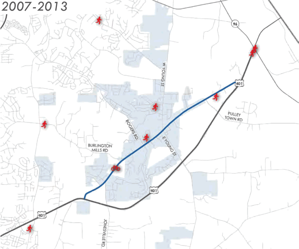
The data suggests there is low danger to pedestrians and cyclists but it can also infer that there are a low number of accidents because there is a low number of cyclists and pedestrians utilizing Main Street. The lower use of Main Street can be due in part to perceived danger, lack of attractions or destinations, lack of amenities, and lack of infrastructure to support pedestrian and cyclist use.
Automobile Crashes
Between 2014 and 2017, 824 vehicle crashes were reported in the Rolesville area (only about 570 are shown on the maps here). The US 401 Bypass officially opened around mid-July 2015 and from January 2014 to the opening 273 crashes took place. From opening the bypass to the end of 2016, 410 crashes took place, with the increase being explained by drivers having to adapt to the new roadway and changing traffic patterns. This is evident in the sharp decrease in crashes evident in the following year, 2017. The table below lists these numbers.
In the 1.5 years prior to the bypass opening, 27.1% of the crashes in the area were located on Main Street. In the year and half after, that percentage dropped to 9.5% and the count itself dropped by over half. In 2017, the percentage raised a bit as the number of area crashes total decreased, but number of crashes on Main Street dropped again — this time by 38.5%.